



Plan all 48 periods with the constraints
Compare eligible markets without allocating the same battery capacity twice, while preserving battery level and efficiency.
TerraSignal is a next-generation distributed energy management platform that optimizes electricity across all energy resources.
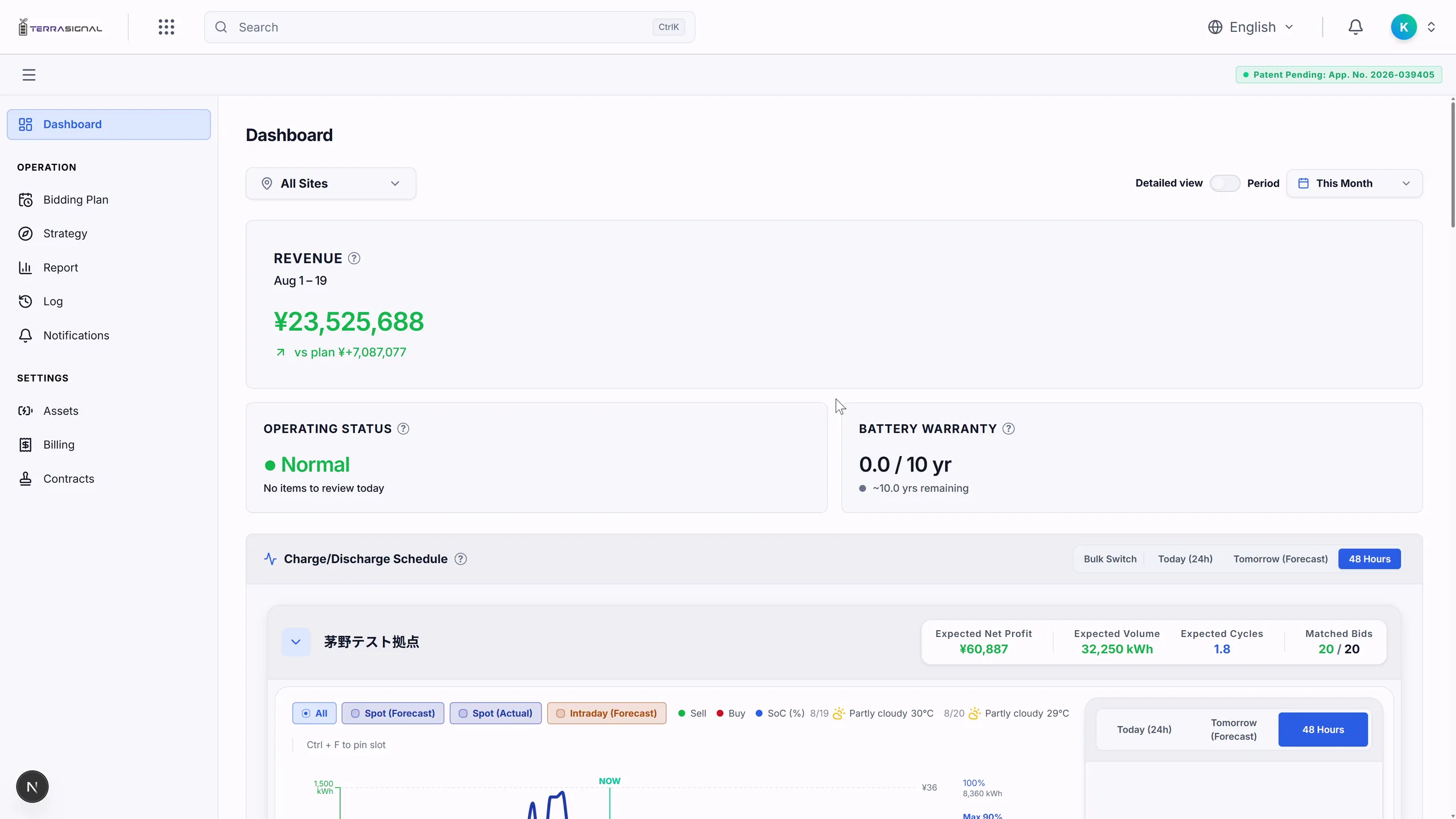
Review prices, charging and discharging, battery level, and the reason behind each decision on one timeline.
Sites, design, markets, and batteries. Manage information that used to be fragmented through TerraSignal services.
For all 48 periods of the next day, TerraSignal Run plans around price, battery level, efficiency, degradation cost, physical limits, and market conditions.
Explore TerraSignal RunCompare eligible markets without allocating the same battery capacity twice, while preserving battery level and efficiency.
Review why each decision was made from price, battery level, degradation cost, market conditions, and the main constraints.
Include charging and discharging degradation cost in the plan, and withhold a bid or operation when that cost cannot be recovered.
For offline primary reserve, use the regulatory cap that applies on the delivery date as the final bid-price ceiling.
Review additions, changes, removals, value differences, and history between the latest and submitted plans.
In connected environments, search and export exchanges with aggregators and energy management systems, command states, and change history.
A patent application has been filed for core technology that builds bidding plans around operating policy while accounting for price-forecast uncertainty and battery degradation cost (Japanese Patent Application No. 2026-039405).
TerraSignal Plan organizes candidate sites, site conditions, layouts, and source materials by project to support early sales and site-development reviews.
Explore TerraSignal PlanCompare early-stage candidates first and focus design effort on the projects with stronger prospects.
Import candidates from CSV files, addresses, or maps, and organize multiple parcels and source data by project.
Review substation distance, hazards, road width, nearby buildings, and slope separately from source and data-completeness information.
Draw, save, and edit site boundaries, roads, buildings, exclusion zones, entrances, and grid-connection points as distinct elements.
Without CAD, evaluate an initial equipment layout while checking boundaries, setbacks, roads, entrances, and equipment interference.
Show whether evidence comes from overview maps, parcel maps, or survey results, and export review PDFs and PNGs plus a DXF file for the design company.
TerraSignal supports development and operation through two services, keeping the basis for decisions visible at each stage.
Use the service suited to each stage: candidate-site and initial-layout review, then next-day operation planning.
Keep price forecasts, condition-based plans, decision explanations, and external connections separate, and track the state of each.
Retain source evidence, plan differences, and command states in a form that can be traced when needed.
Detect missing or stale data, empty results, and fewer than 48 periods instead of treating an abnormal state as normal.



.jpeg)